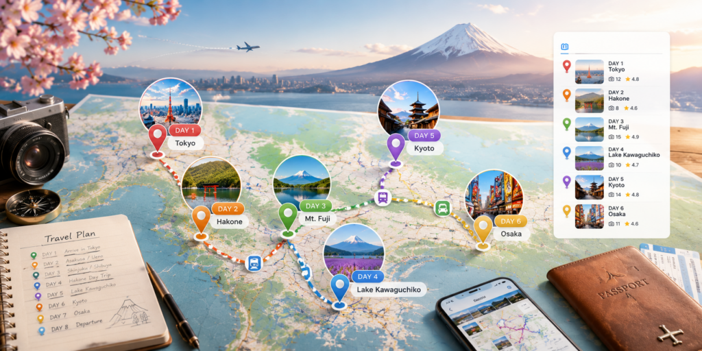
PhotoGeoMap works best when the map becomes the first thing people see. Upload photos from a trip, let GPS data fill the coordinates, then group the places into an album.
For a travel diary, this creates a natural route. Friends can open the shared link, move through the markers, and see each memory in its real location.
Discussion
0 commentsNo comments yet. Start the conversation.