
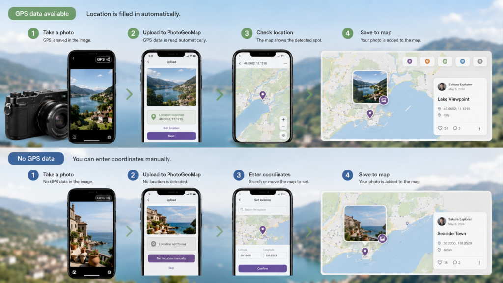
Many phones and cameras can save GPS metadata inside image files. When that data is present, PhotoGeoMap fills latitude and longitude automatically during upload.
If GPS is missing, users can still enter coordinates manually, then save the photo to the map.
Discussion
0 commentsNo comments yet. Start the conversation.